Housing Types
Algorithm to determine the housing type for all buildings in The Netherlands with Open Data
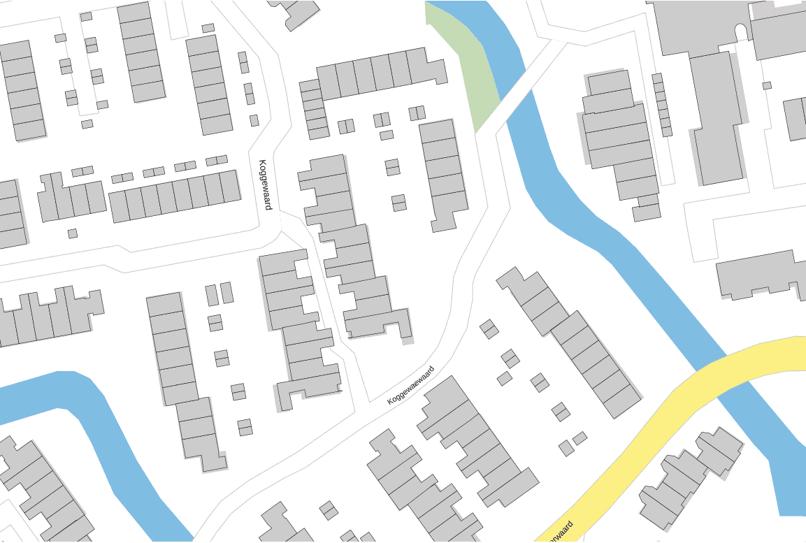
For this project we used only Open Data (Kadaster, BAG, and CBS). Housing types were determined by comparing the GIS buildig contour for all buildings within a neighbourhood. Kadaster GIS contour data (2D polygons) were imported and cleaned up with Python. The required 2D vector algebra to determine the distance between line segments and objects was implemented with custom Python classes. Combined with BAG building functions it was possible to classify each object into a standardized dutch housing classification of vrijstaand, tussenwoning, hoekwoning, twee onder een kap, and appartement (with subtypes). Results were verified using bagviewer.kadaster.nl.
My Contribution
- Algorithm design
- Data cleanup and processing pipeline
- Implementation in Python
- Exposure via API
Images and Screenshots
Example of contour data used to determine housing type:

External Links
Highlights
- Classification of every building in The Netherlands
- Housing type is not part of Open Data and was therefore a unique selling point for the client
- Classification was integrated in the data ingestion pipeline for automatic updates
Users
- multiple international energy corporations
- local governments
- several smaller clients
Technology Stack
PythonalgorithmsAWS LambdaAWS ApiGatewayPostGISPostgres